Dugandan was named after the Dugandan pastoral station (1844) which ran north-east from Boonah to Mt Joyce.
Farm selections in the Dugandan area began in the mid-1870s and the Dugandan School was opened in 1878. The town of Dugandan was surveyed, generally west of Rathdowney Road and High Street, containing the school, some sawmills and a store (it was to the east of the town survey that the Blumberg brothers opened another store in 1882, the beginning of the town of Boonah). In 1887 a flood inundated Dugandan and the higher ground around Blumberg's store became the favoured area.
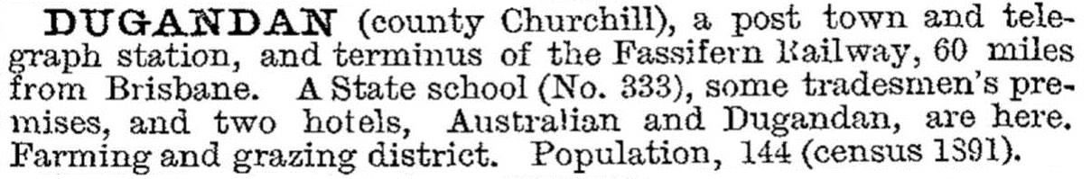
The railway (1887) brought about a change of name, local residents choosing Boonah, and for about 20 years the town was described as 'Boonah and Dugandan'. The local show society was the Fassifern and Dugandan Agricultural and Pastoral Society. As late as 1949 the post office directory listed two sawmills in Dugandan, along with numerous farmers (mostly German surnames) and the Dugandan hotel. Dugandan was described in the 1903 Australian handbook:
The name continues with the Dugandan Park at the corner of Rathdowney and Mt French Roads, opposite the hotel.
Both the Boonah Airport and Boonah Golf Club are in Dugandan.
Dugandan's census populations have been:
| Census Date | Population |
|---|---|
| 1891 | 144 |
| 1901 | 313 |
| 1911 | 530 |
| 1933 | 437 |
| 1947 | 352 |
| 2006 | 172 |
| 2011 | 395 |
C.K. Pfeffer, The Fassifern story: a history of Boonah Shire and surroundings to 1989, Boonah, Boonah Shire Council, 1991

