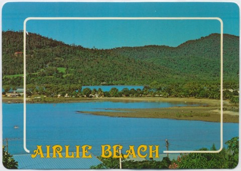
Airlie Beach, a coastal resort town near the Whitsunday Islands, is 20 km north-east of Proserpine and 110 km north of Mackay.
An early European settler in the area, Thomas Abell, took up land in 1904 for growing vegetables and tropical fruit. His family also had timber leases on some of the offshore islands. In 1935 the Lands Department offered some land fronting the water for selection and asked the Proserpine Council for a name. The council's chair suggested 'Airlie', perhaps commemorating his Scottish childhood near the Parish of Airlie. The suggestion held, and soon after land sales in 1936 the locality became known as Airlie Beach. The nearest neighbouring settlement was Cannonvale, about two kilometres west.
When a post office was opened in 1959 it was recorded that Airlie Beach had 83 residences, 59 permanently occupied. Most families were engaged in farming. The Bruce Highway from Brisbane to Cairns was in the course of construction and Proserpine business interests turned their attention to prospects for Whitsunday tourism. There was already a campaign afoot to create a harbour for Proserpine sugar, and the loss of the Cannonvale jetty to cyclone damage brought the sugar and nascent tourism industries together in a push for appropriate facilities. The result of this joint effort was Shute Harbour, opened in 1961. Ten kilometres east of Airlie Beach, Shute Harbour was devoted exclusively to tourism after sugar was transferred to bulk handling facilities at Mackay.
Airlie Beach began to develop as a resort, sharing in the growing Whitsunday tourist industry, and becoming a destination in itself. The Airlie Beach Hotel Motel opened in 1968. An airport between Airlie Beach and Shute Harbour was opened for Reef Airflights, and the whole area from Cannonvale to Shute Harbour was aggregated into the town of Whitsunday (1987).
Airlie Beach has a marina, a sailing club, numerous restaurants, shops and is Whitsunday's entertainment centre. The town offers a range of budget accommodation options, including caravan parks in Cannonvale and Jubilee Pocket, backpacker hostels and holiday flats. Resort hotel complexes are more recent additions, with waterfront views out to the islands. Airlie Beach lagoon, with three stinger-free swimming pools, was opened in 2001. Each year about 3000 high school leavers or 'schoolies' choose Airlie Beach for a week's holiday.
Between Airlie Beach and Shute Harbour there is the Conway National Park (22,500 ha, 1982) part of a densely forested range that ends with Cape Conway, which was named by Lieutenant James Cook in 1770.
To cope with increased usage, a new 45 metre footbridge was constructed in 2009 connecting the lagoon to the parks in the main street along Airlie Creek and a major main street redevelopment was completed in August 2013. Two ambitious developments – the Meridien Marinas' Port of Airlie and the Abel Point Marina – both went into receivership in 2011 citing the GFC, cyclones and the tourism downturn. A land parcel at Waterson Way was sold by the council to Chinese investors in 2014 for a retail, commercial and entertainment 'Chinatown' precinct.
Cyclones are an ever present threat to the coastal town with Cyclone Ului (2010) and Cyclone Yasi (2011) both causing damage to yachts, roofs and the widespread loss of power.
Airlie Beach's census populations have been:
| Census Date | Population |
|---|---|
| 1966 | 235 |
| 1976 | 971 |
| 1991 | 2524 |
| 2001 | Residents 3029 Visitors 1157 |
| 2006 | 2751* |
| 2011 | 909 |
* Includes Jubilee Pocket, Mandalay and Flametree
Todd Barr, No swank here? The development of the Whitsundays as a tourist destination to the early 1970s, Townsville, Department of History and Politics and Department of Tourism, James Cook University, 1990
Ray Blackwood, The Whitsunday Islands: an historical dictionary, Rockhampton, Central Queensland University Press, 1997
Cannonvale entry


