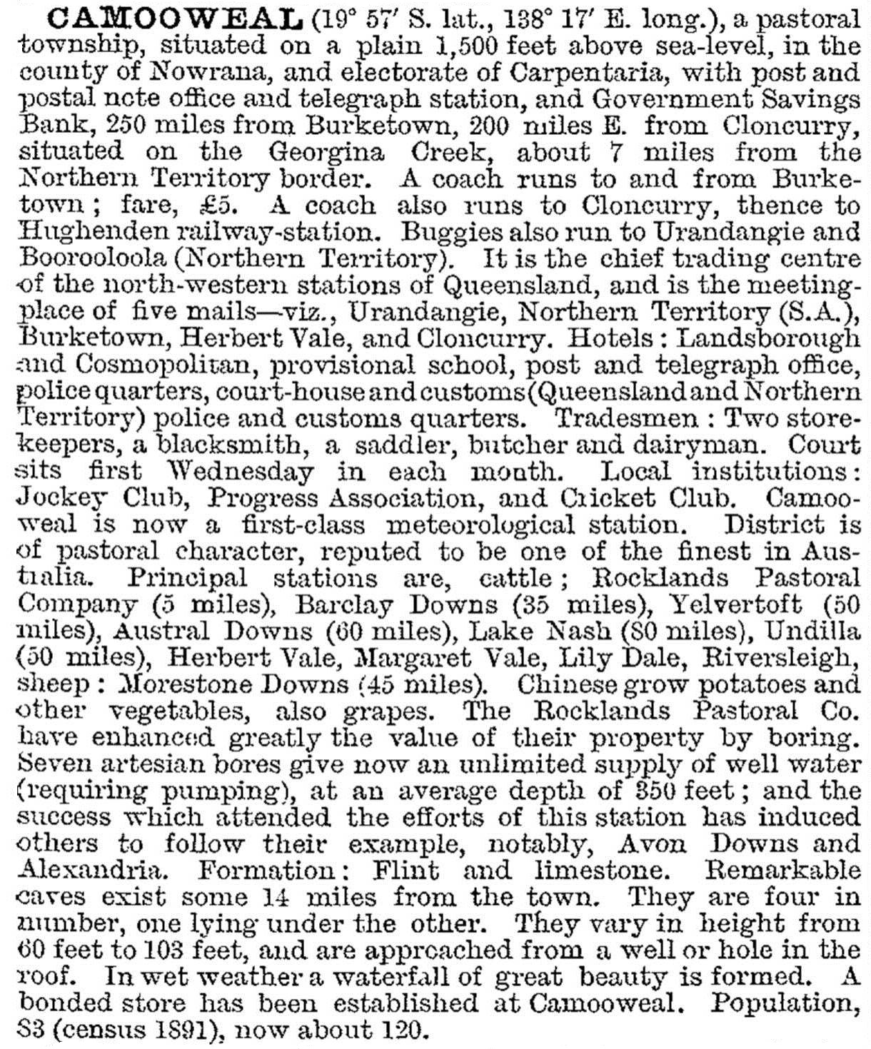
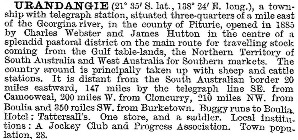
The Barkly Tableland lies mostly in the Northern Territory. Its northern limit sits about 100 km back from the coastline of the Gulf of Carpentaria and its southern boundary extends along a line from Tennant Creek, Northern Territory, to Urandangie in Queensland. Its eastern limit edges the Isa uplands. The main Queensland town on the Tableland is Camooweal, which was the administrative centre of Barkly Tableland Shire (1914-63). Camooweal and Urandangie were described in the 1903 Australian handbook:
Barkly Tableland Shire was merged with part of Cloncurry Shire and renamed Mount Isa Shire in 1963.
The Tableland was explored by William Landsborough in 1861 which he named Barkly's Plains after the Governor of Victoria, Sir Henry Barkly. His description of the place as a plain is probably the better one, as the elevation averages 300 metres and flatness is a notable feature, along with a treeless, endless vista of Mitchell grass.
Camooweal is on the upper reaches of the Gregory River where there are shallow valleys fed by springs or bore water. They provide good pasture for cattle fattening, as livestock is brought from the Tableland to the western Queensland railheads. Camooweal was gazetted as a town in 1884. In its role as the chief depot for western pastoral stations it sustained two hotels and several storekeepers (Pugh's Directory, 1924). It hosts the Barkly Tableland heritage centre.
Barkly Tableland Shire was described as follows in the 1946 Australian Blue Book:

The shire's census populations were:
| Census Date | Population |
|---|---|
| 1921 | 1029 |
| 1933 | 747 |
| 1954 | 422 |
Mollie Bayne, The Barkly Tableland, London, Longmans, 1957


