Flinders Shire, an area of 41,538 sq km, is generally 320 km south-west of Townsville. Its administrative and geographic centre is Hughenden.
The shire's northern part is in the Dividing Range where the headwaters of the Flinders River, Porcupine Creek, are found. The Flinders, Queensland's longest river which was named in 1841 after Captain Matthew Flinders, empties into the Gulf of Carpentaria. Below the Dividing Range the river passes through black soil basaltic plains. In times of good rainfall (annual average is 485mm) the pasture is nutritious and plentiful. Pastoral settlement began in 1863 and the forerunner of the shire, the Hughenden division, was formed in 1882. Five years later the railway from Townsville was extended to Hughenden, which also served as a railhead until extensions to Winton (1899) and Richmond (1904). Upon the railway arriving at Hughenden the town was made a separate municipality, remaining so until amalgamation with the shire in 1958. Richmond Shire was severed from Flinders in 1915.
Hughenden since 1891 has held between 56-65% of the town and shire's population. Other population centres, Prairie, Torrens Creek and Stamford, are all on the railway line. Prairie has a school (1894) and a hotel-motel. Torrens Creek's school (1891) has closed, but the settlement has a hotel and a garage. Beyond these places the shire is vast pastoral holdings, between them running 227,000 beef cattle and 496,000 sheep and lambs (1993). There is a municipal saleyard in Hughenden.
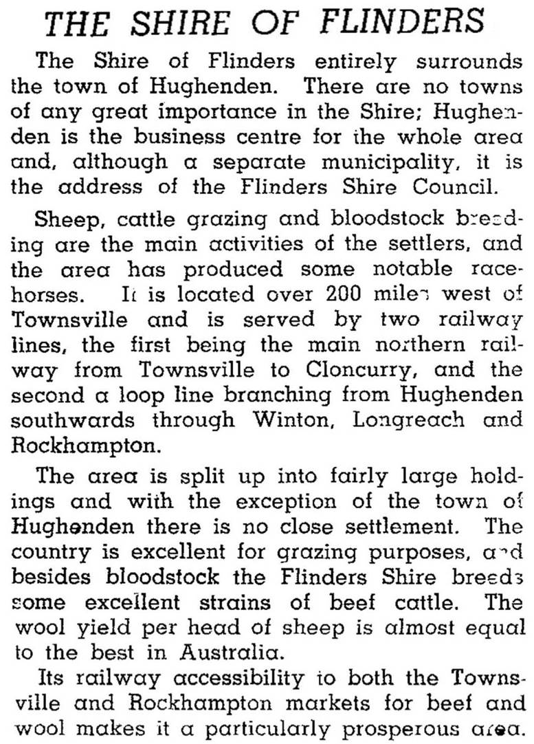
Flinders Shire was described in the 1946 Australian Blue Book:
In the north of the shire there are the Porcupine Gorge and White Mountains national parks. Porcupine Creek has cut through basalt and softer underlying sedimentary rock, forming in parts a gorge 150 metres deep. It contains a rich variety of bird life. The larger White Mountains national park also has several gorges.
In 2012 a new Council Administration Building was constructed in Gray Street, Hughenden. The following year the town clock (1968) originally in the centre of Gray and Brodie Streets was relocated by the council to the centre of Gray Street in front of the Flinders Discovery Centre.
Flinders Shire's census populations have been:
| Shire without Hughenden |
Hughenden | Shire with Hughenden |
|
|---|---|---|---|
| 1911 | 1 2015 | 1414 | n/a |
| 1921 | 2 1087 | 1881 | n/a |
| 1933 | 1603 | 1823 | n/a |
| 1954 | n/a | n/a | 3293 |
| 1961 | n/a | n/a | 3953 |
| 1976 | n/a | n/a | 2875 |
| 2001 | n/a | n/a | 2191 |
| 2006 | n/a | n/a | 2946 |
| 2011 | n/a | n/a | 1791 |
Brian T. Langan, Official souvenir of the centenary of settlement in Hughenden and district 1863-1963, Hughenden, Hughenden and District Centenary Celebrations Committee, 1963
Hughenden entry


