Karumba is a coastal town in the Gulf of Carpentaria, at the mouth of the Norman River downstream from Normanton. It is at the end of the Matilda Highway which begins at Cunnamulla.
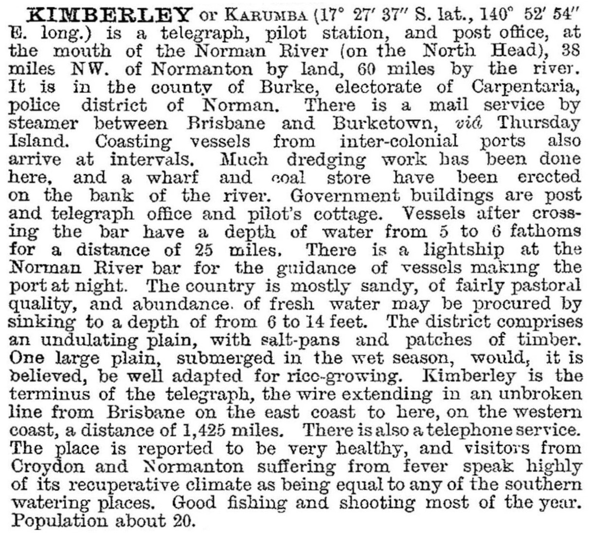
A settlement named Kimberley at the mouth of the Norman River was to be the terminal of the overseas cable from Java, but the cable route was changed to Darwin. Kimberley, however, was also a supply point for vessels trading in the Gulf, particularly for those unable to manoeuvre in the shallows of the Norman River. In the early 1900s the name was changed to Karumba, thought to be an Aboriginal place name for the locality. Kimberley/Karumba was described in 1903 in the Australian handbook:
Along with Normanton, Karumba declined as the freight traffic decreased with the closure of the Croydon minefield after 1913. A short-lived meatworks operated in the 1930s, and a sheltered part of the river was used as a pre-war flying boat base for refuelling. A Catalina long-range bomber base operated there during the war with up to nearly 1000 aircraft personnel on duty. During the 1950s basic services and accommodation were established for fishing, pig and crocodile hunting, and duck shooting. The river delta is noted for barramundi and other game fish, the best season being April to August.
In 1963 prawn fishing and processing were started at Karumba, and port facilities were developed for live cattle exports. Recreational fishing has become an important industry, allied with boat hiring, several motels, holiday units and caravan park accommodation. Tours of the extensive wetlands and tidal inlets are a further attraction.
Since the 1990s prawn processing has moved off shore, with 'mother' ships freezing the catch for direct transport overseas. The port, however, was enlarged in the later 1990s for export of concentrates from Pasminco's zinc and lead mine at Lawn Hill.
Karumba has local shops, hotels, a P-7 school (1968), an aerodrome, an outpatient clinic, a church and a neighbourhood centre. There are also facilities at Karumba Point including a caravan park. Its census populations have been:
| Census Date | Population |
|---|---|
| 1961 | 50 |
| 1971 | 359 |
| 1981 | 670 |
| 1996 | 1043 |
| 2001 | 1346 |
| 2006 (excluding tourists and visitors) |
518 |
| 2011 | 587 |
Sue Neales, The Gulf country, Terrey Hills, Australian Geographic, 2000
Normanton centenary 1868-1968, Normanton, Normanton Centenary Committee, 1968
The centenary project: draft impact assessment study report, 1994


