Kingaroy Shire, an area of 2422 sq km and generally 180 km north-west of Brisbane, was amalgamated with three other shires to form South Burnett Regional Council in 2008. It was named after the town of Kingaroy (c1904), and the name is thought to have been derived from an Aboriginal word describing a small black ant or a red ant.
The Kingaroy area was under the Nanango Shire, but Kingaroy benefited from having a railway during 1904-11 while Nanango lacked a line. The town's progress association and Chamber of Commerce agitated for municipal separation and in 1912 Kingaroy Shire was formed by severances from Nanango, Wambo and Wienholt Shires. Its area was 1070 sq km and shire offices were built in 1913. The eastern side of the Shire was its populous area, served by branch railway extensions from Kingaroy to Nanango (1911) and to Tarong via Taabinga Village (1915).
The south-western sector of the Shire is in the Great Dividing Range and includes the Bunya Mountains. A national park (1908, 11,700 ha), the second to be proclaimed in Queensland, preserves significant stands of Bunya pine trees, a species much sought-after by colonial timber cutters. The Stuart River, headwatered in the Bunyas, flows through Kingaroy's fertile farm areas, and Lake Barambah dam in the neighbouring Nanango Shire is also fed by Bunya waters.
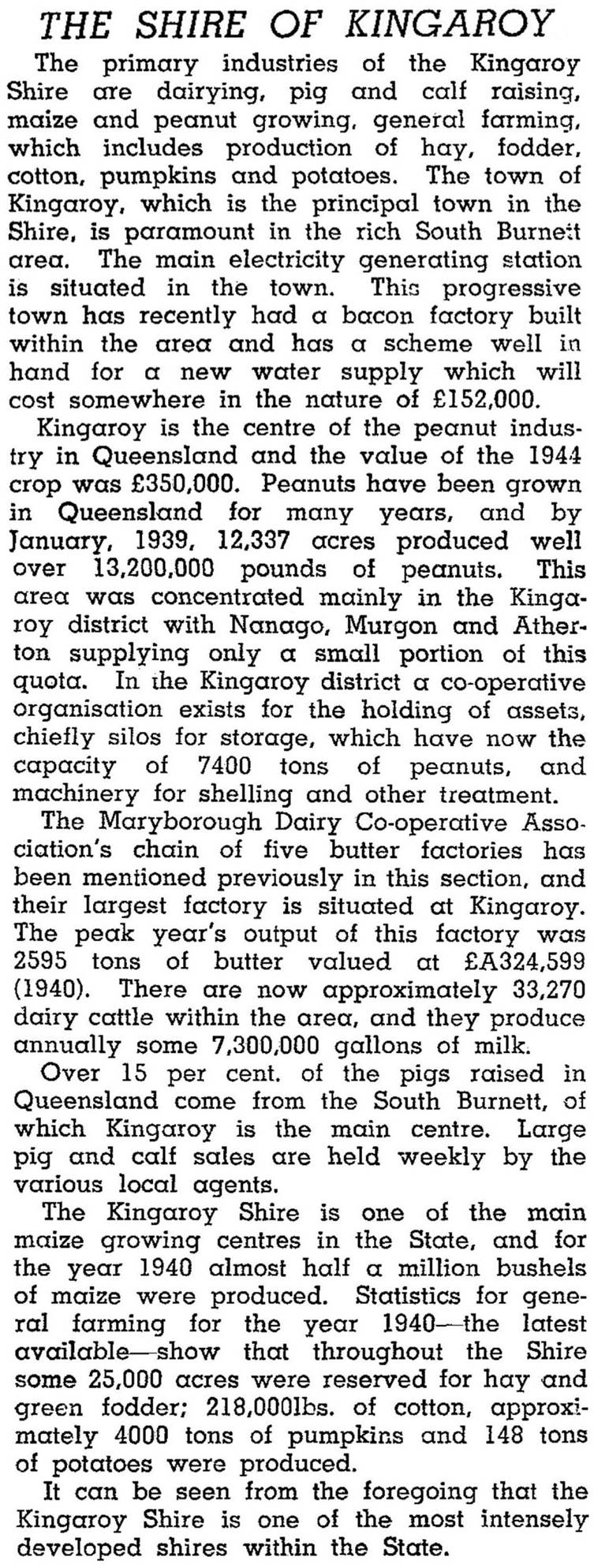
Intensive dairying supplied a large butter factory (1907) at Kingaroy, and by the 1920s peanut farming was increasing. Navy beans were first grown in 1942, and crops quickly expanded, supplying government contracts. In 1946 Kingaroy Shire was described in the Australian Blue Book:

Postwar agriculture further diversified into fruits, vegetables, lentils and wine grapes. Dairying, however, began to decline in the 1960s under a cost-price squeeze (stronger government regulation and competition from foreign producers). As more dairy farmers withdrew, dairy factories in the South Burnett were closed during the 1970s, and the last one to close was in Murgon in 1995. In 1993 the Shire had 56,600 beef cattle, 1300 dairy cattle, 27,000 pigs, 11,700 ha under cereals and over 17,000 ha under fodder, legumes and other field crops.
Kingaroy Shire's census populations were:
| Census Date | Population |
|---|---|
| 1921 | 4893 |
| 1933 | 6844 |
| 1947 | 8066 |
| 1971 | 7868 |
| 1986 | 9902 |
| 2001 | 11,387 |
Tony Matthews, Landscapes of change: a history of the South Burnett, Wondai, South Burnett Local Government Association, 1997
Harold Mears, The first 100 years of Kingaroy district, Kingaroy, Kingaroy Shire Council, 1978
Booie, Coolabunia, Kingaroy and Taabinga entries


