Torres Strait is an island-studded sea passage between Cape York and Papua New Guinea, with the Arafura Sea on its west and the Coral Sea on its east. It was named by Alexander Dalrymple, British hydropher, after Luis Vaez de Torres, Spanish navigator. De Torres encountered the strait in 1606 when he parted from an expedition from Peru in search of Terra Australis Incognito. He finally journeyed to the Philippines via the Moluccas.
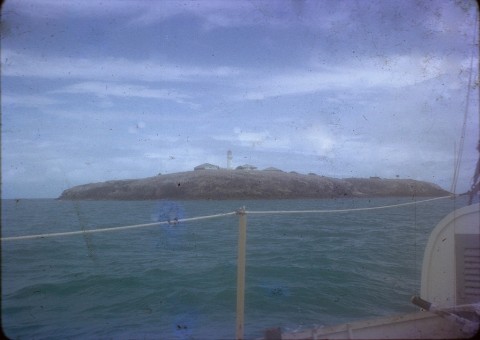
The strait is about 160 km wide between Cape York and Papua New Guinea, with numerous shoals and strong tidal currents. There are two main navigation passages: the Prince of Wales Channel north of Hammond Island and Endeavour Strait between Cape York and the Prince of Wales Island. There are four main island groups, as indicated below by the islands with significant populations recorded in the census.
| Group | Main Islands | Population | |
|---|---|---|---|
| 2006 | 2011 | ||
| High western islands, a continuation of the Australian dividing range | Thursday | 2546 | 2610 |
| Horn (Narupai) | 585 | 539 | |
| Prince of Wales (Muralag) | 120 | 87 | |
| Hammond (Kiriri) | 208 | 225 | |
| St Pauls (Moa) | 239 | 258 | |
| Kubin | 226 | 155 | |
| Badu | 786 | 783 | |
| Mabuiag | 240 | 260 | |
| Central islands, low coral cays | Yorke (Masig) | 336 | 238 |
| Coconut (Poruma) | 239 | 218 | |
| Sue (Warraber) | 175 | 145 | |
| Yam (Iama) | 363 | 299 | |
| Eastern islands, mostly volcanic landforms | Murray group Maer (Mer), Diwar, Waier | 462 | |
| Mer | 365 | ||
| Darnley (Erub) | 320 | 343 | |
| Stephens (Ugar) | 57 | 48 | |
| Northern group, alluvial landforms close to Papua | Boigu | 295 | 208 |
| Saibai | 368 | 480 | |
| Dauan | 120 | 130 | |
Saibai is about four km from Papua, the northern-most point of Australia's international boundary. The Murray Islands are about 200 km north-east of Cape York, and often omitted from atlases. Maer Island was the home of Eddie Koiki Sambo, later Eddie Mabo (c1936-1992), who successfully mounted in the High Court the challenge to the terra nullus doctrine (the Mabo land-rights decision).
Many Torres Strait Islanders are of Melanesian origin. Their two languages, Yagar-Yagar (western islands) and Meriam (eastern islands) are Australian and Papuan in origin. The population of the islands today reflects shipping movements and migration patterns, including Aboriginal, Melanesian, Chinese, Japanese and a number of other Asian influences. Most Europeans are government employees and usually only stay for a few years.
European pearlers and trepangers set up enterprises in Torres Strait in the 1870s, recruiting Islanders to work for them. The London Missionary Society arrived in 1871 and in 1877 the Queensland government put a Resident and Police Magistrate on Thursday Island. Two years later the islands became part of Queensland, with the approval of the British government. Most of the island communities were left alone, although their mariner populations were engaged as deck hands and pearl-shell harvesters. In general, and in the eastern islands in particular, the Islanders were less pliable than Malays and Japanese, whom employers preferred. Many male Islanders enlisted in the Australian Army during World War II and returned home with deferred pay to find a pearl-shell industry devoid of foreign labour. There was a decade of prosperity and then the collapse of pearl shell under the impact of plastics in the late 1950s. Many Islanders found employment on the Australian mainland, especially in the Cairns region.
Under the impacts of Christianity and with increasing numbers of Islanders choosing to live on the mainland, Islander customs and marriage protocols have changed. The mortuary custom of tombstone opening (i.e. unveiling) has continued. It usually happens a few years after death and interment, when grieving is over, and far-flung family members meet to celebrate the life of the deceased. Eddie Mabo's tombstone opening at the Townsville cemetery occurred three years after his death, although the ornate tombstone and his remains were moved to Maer Island after racist desecration.
Local government in Torres Strait began with the Torres Division in 1885, which became Thursday Island Town Council in 1912 and Torres Shire in the 1970s. In 2002 local councils were elected for each of the 15 islands listed from Hammond to Dauan (both inclusive) in the above table. In 2008 they were amalgamated as one, the Torres Strait Island Regional Council. Torres Strait Shire (Thursday, Horn and Prince of Wales Islands, and parts of Cape York) was left unchanged. Both councils are headquartered at Thursday Island.
A third local-government area with a significant Torres Strait population is Northern Peninsula Area Regional Council at the top of Cape York. It includes the community of Bamaga, with most of that population hailing from Saibai Island. Separate from these bodies is the Australian Government's Torres Strait Regional Authority (1994) which formulates and implements programs for Torres Strait Islanders.
Government education in Torres Strait is provided by Tagai State college, with primary campuses on Horn and Thursday islands, and all the islands listed in the above table from St Pauls to Dauan (Maer has the school for the Murray group). The secondary campus is on Thursday Island, where a Catholic school is also located.
The census population of the Torres Strait Regional Council have been;
| census date | population |
|---|---|
| 2011 | 3256 |
The Torres Strait is often mentioned in weather reports because of high winds. Residents move between the islands in small boats and are careful to check the weather conditions before setting out.
Jeremy Beckett, Torres Strait Islanders: custom and colonialism, Melbourne, Cambridge University Press, 1987
J. Singe, The Torres Strait: people and history, St Lucia, University of Queensland Press, 1989
Steve Mullins, Torres Strait: a history of colonial occupation and culture contact 1864-1897, Rockhampton, University of Central Queensland Press, 1994
Gerald Peel, Isles of the Torres Straits: an Australian responsibility, Sydney, Current Book Distributors, 1947
Badu, Bamaga, Cape York Peninsula, Horn Island, Murray Island, Northern Peninsula Area Regional Council, Thursday Island and Torres Shire entries